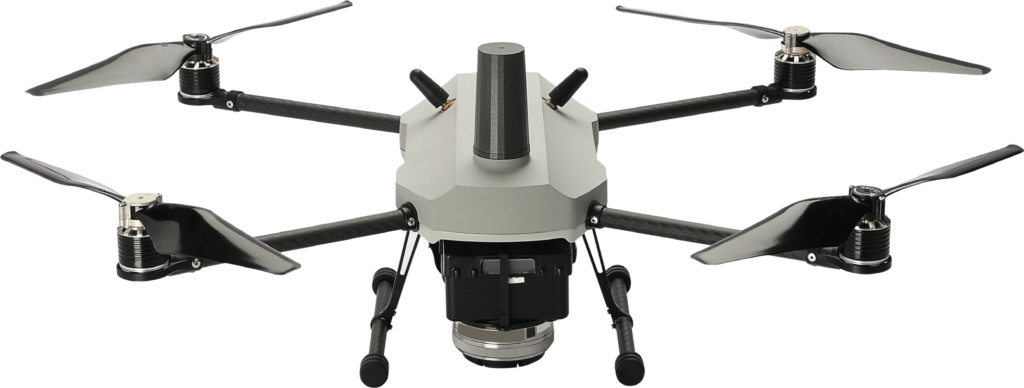
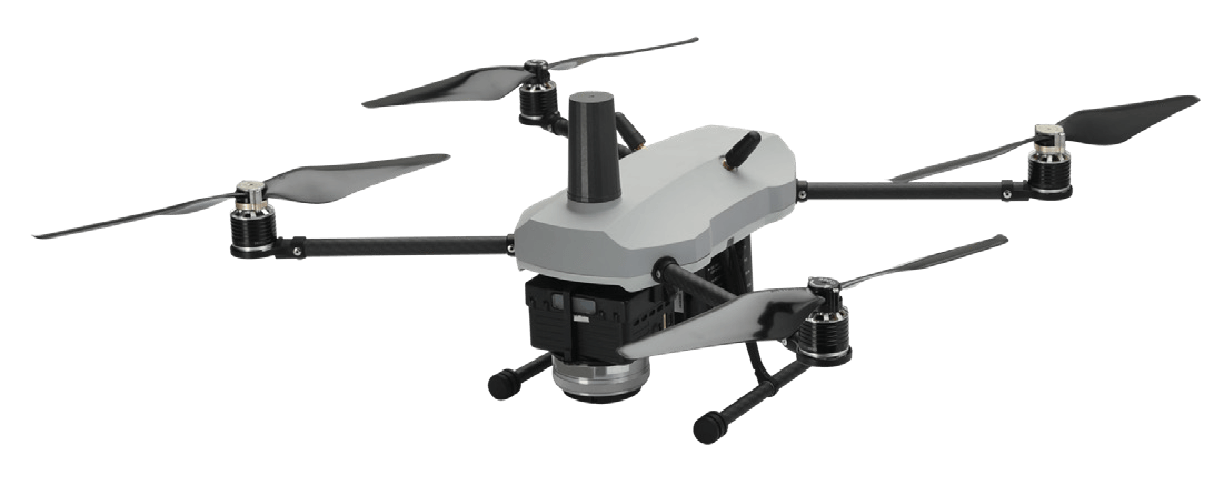
The A200™ is India’s first sub 2 kg drone certified by the DGCA. Being lightweight, portable, and equipped with highperformance sensors, it is ideal for surveying and mapping applications across industries.
High Performance
Easy to Operate
Long Endurance
Top Notch Technology
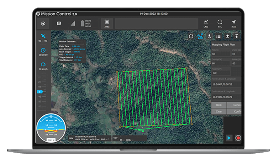
Start your mapping or surveillance with A200
Compact for single person operations
Compact, lightweight drone under the micro category (<2 kg).
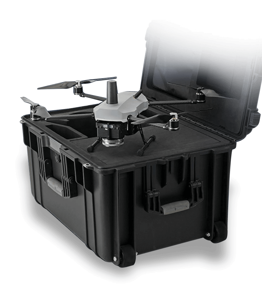
Single rugged dust and waterproof hardcase makes it highly portable & secure.
Survey-grade accuracy in X, Y and Z
L1/L2 multi-band GNSS receiver with full PPK capability captures precise geotags of each image.
Ideal for survey-grade mapping with accuracy of <10 cm in X & Y and <20 cm in Z axis orthophotos.
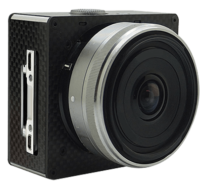
High resolution imaging for all mapping applications
24.1 MP imaging camera with an APS-C sensor captures sharp and hi-res images.
Intuitive and easy to use
A200™ proprietary Mission Control Software(MCS) ensures effortless piloting and advanced flight planning for mapping applications.
Feature
System Feature
Tool-less assembly & disassembly.
<100 Wh batteries for easy transport.
Automated operation from take-off to landing.
Fail-safe for low battery, communication loss, high wind.
Digital communication link in license free band.
Operable by single person.
Specifications
Speed, Altitude, Endurance, Battery, GPS, and Payload
Basic
All Up Weight - <2 kg
Endurance - 35 mins
Operating Temperature -20 to + 55 Degree Celsius
Speed
Speed - 10 m/s
Wind Resistance - Up to 35 km/hr
Flight Altitude - Up to 120m AGL
Service Ceiling - Up to 2000m AMSL
Control
Communication Range - 2 km
Flight Modes - Semi Autonomous & Full Autonomous
Payload
24.1 MP imaging camera with an APS-C sensor captures sharp and hi-res images
Fail Safe Features
DATALINK DISCONNECT
Automatically Return to Home when the data link disconnect.
LOW BATTERY
UAV automatically Return to home on Low Battery Indication.
GPS SIGNAL FAILS
UAV Return to Home on GPS fails or GPS glitch.
ALTITUDE OVER LIMIT
UAV Return to Home on Altitude Angle Over Limit.
Services
Below services are suitable for this type of drone
Surveillance
Use the drone for all type of surveillance & crowed monitoring.